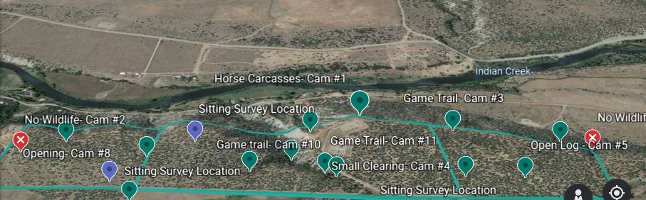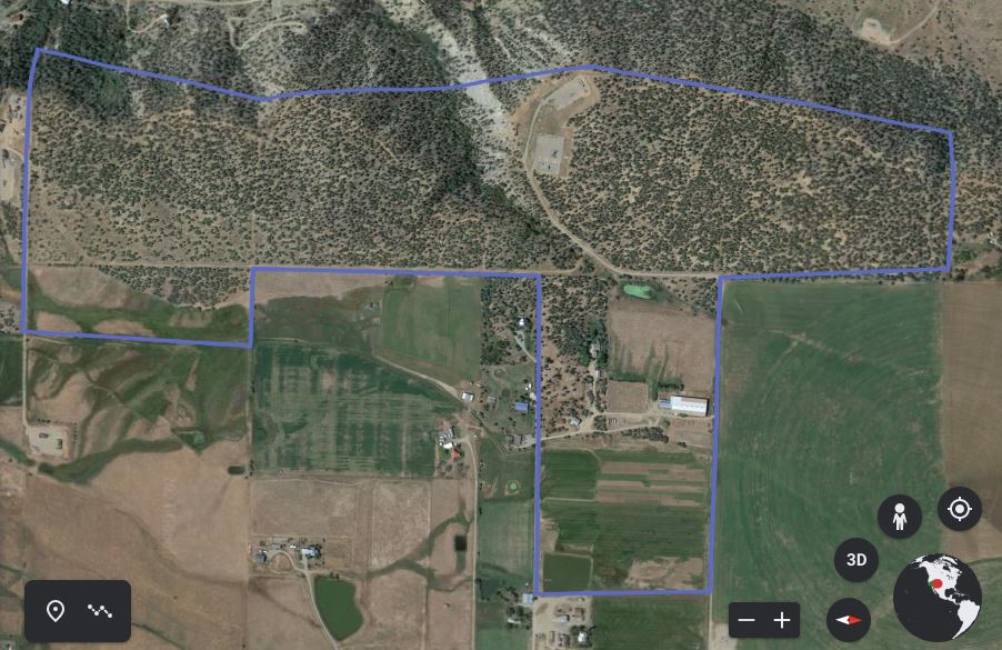
LINK Project
For my LINK Project I created a presentation and write up about my LINK experience and project as a whole. I also created a spread sheet with the compiled data that I transferred from my field note book, and google earth project that I created; where the property is out lined, with sitting surveys and camera trap locations marked on it.